![](/images/other/stat-length.png)
![Tocht Te voet Loučná nad Desnou - NS S Koprníčkem na výlet Keprnickými horami - Photo](https://media.geolcdn.com/t/1900/400/35abbe2b-020c-4ec1-afd2-2da4b71f8098.jpeg&format=pjpeg&maxdim=2)
NS S Koprníčkem na výlet Keprnickými horami
SityTrail - itinéraires balisés pédestres
Tous les sentiers balisés d’Europe GUIDE+
![Lengte](/images/other/stat-length.png)
Lengte
12 km
![Max. hoogte](https://static1.geolcdn.com/siteimages/upload/files/1508320355ic_sort_altitude_max_24dp.png)
Max. hoogte
1415 m
![Positief hoogteverschil](https://static1.geolcdn.com/siteimages/upload/files/1508320355ic_sort_den_pos_24dp.png)
Positief hoogteverschil
363 m
![Km-Effort](/images/other/stat-length.png)
Km-Effort
18,2 km
![Min. hoogte](https://static1.geolcdn.com/siteimages/upload/files/1508320355ic_sort_altitude_min_24dp.png)
Min. hoogte
758 m
![Negatief hoogteverschil](https://static1.geolcdn.com/siteimages/upload/files/1508320355ic_sort_den_neg_24dp.png)
Negatief hoogteverschil
752 m
![Boucle](https://static1.geolcdn.com/siteimages/upload/files/16400158638029165_repeat_loop_refresh_sync_direction_icon.png)
Boucle
Neen
Markering
Datum van aanmaak :
2025-02-07 12:55:24.423
Laatste wijziging :
2025-02-07 12:55:24.423
![Te voet](https://static1.geolcdn.com/sitytour/trail-icons/100.png)
4h07
Moeilijkheid : Gemakkelijk
![Scan deze QR-code om de tocht te openen in de SityTrail-applicatie](https://capi.geolives.com/qq0zvz2zws4bq2lad0pu/sitytour/trails/4345628/qr.png?size=200)
Gratisgps-wandelapplicatie
Over ons
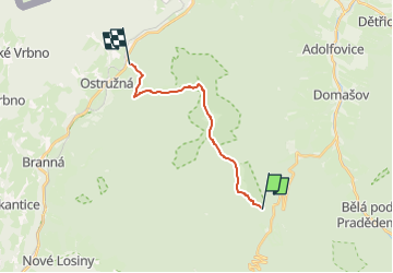
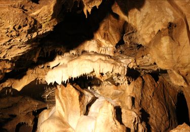
Tocht Te voet van 12 km beschikbaar op Centraal-Moravië, Olomoucký kraj, Loučná nad Desnou. Deze tocht wordt voorgesteld door SityTrail - itinéraires balisés pédestres.
Beschrijving
Tocht aangemaakt door cz:ČZT.
Plaatsbepaling
Land:
Czech Republic
Regio :
Centraal-Moravië
Departement/Provincie :
Olomoucký kraj
Gemeente :
Loučná nad Desnou
Locatie:
Unknown
Vertrek:(Dec)
Vertrek:(UTM)
653624 ; 5555796 (33U) N.
Opmerkingen
Wandeltochten in de omgeving
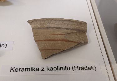
![Tocht Te voet Vrbno pod Pradědem - [M] Vrbno pod Pradědem - U Obrázku - Photo](https://media.geolcdn.com/t/375/260/71a2ca10-9765-44fa-b01a-89152dd82c9d.jpeg&format=jpg&maxdim=2)
![Te voet Te voet](https://static1.geolcdn.com/sitytour/trail-icons/100.png)
[M] Vrbno pod Pradědem - U Obrázku
Te voet
Medium
Vrbno pod Pradědem,
Moravië-Silezië,
Moravië-Silezië,
Czech Republic
![](/images/other/stat-length.png)
20 km | 29 km-effort
6h 40min
![](https://static1.geolcdn.com/siteimages/upload/files/16400158638029165_repeat_loop_refresh_sync_direction_icon.png)
Neen
![Tocht Te voet Vrbno pod Pradědem - NS Vyhlídka Praděd - Photo](https://media.geolcdn.com/t/375/260/9ce65572-d29d-4b28-b053-1d4917c8ec30.jpeg&format=jpg&maxdim=2)
![Te voet Te voet](https://static1.geolcdn.com/sitytour/trail-icons/100.png)
NS Vyhlídka Praděd
Te voet
Gemakkelijk
Vrbno pod Pradědem,
Moravië-Silezië,
Moravië-Silezië,
Czech Republic
![](/images/other/stat-length.png)
3,6 km | 6,1 km-effort
1h 23min
![](https://static1.geolcdn.com/siteimages/upload/files/16400158638029165_repeat_loop_refresh_sync_direction_icon.png)
Ja
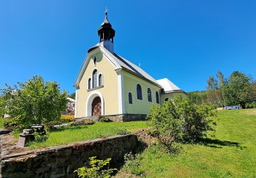
![Tocht Te voet Rapotín - [Ž] - Photo](https://media.geolcdn.com/t/375/260/ca426870-e86c-4a96-bde0-2f91190915ef.jpeg&format=jpg&maxdim=2)
![Te voet Te voet](https://static1.geolcdn.com/sitytour/trail-icons/100.png)
[Ž]
Te voet
Gemakkelijk
Rapotín,
Centraal-Moravië,
Olomoucký kraj,
Czech Republic
![](/images/other/stat-length.png)
7,4 km | 11 km-effort
2h 29min
![](https://static1.geolcdn.com/siteimages/upload/files/16400158638029165_repeat_loop_refresh_sync_direction_icon.png)
Ja
![Tocht Te voet Malá Morávka - Nová ves - Rýmařov - Photo](https://media.geolcdn.com/t/375/260/47c50813-5fcb-47f8-851e-4b2337df6fb6.jpeg&format=jpg&maxdim=2)
![Te voet Te voet](https://static1.geolcdn.com/sitytour/trail-icons/100.png)
Nová ves - Rýmařov
Te voet
Gemakkelijk
Malá Morávka,
Moravië-Silezië,
Moravië-Silezië,
Czech Republic
![](/images/other/stat-length.png)
8,9 km | 11,1 km-effort
2h 31min
![](https://static1.geolcdn.com/siteimages/upload/files/16400158638029165_repeat_loop_refresh_sync_direction_icon.png)
Neen
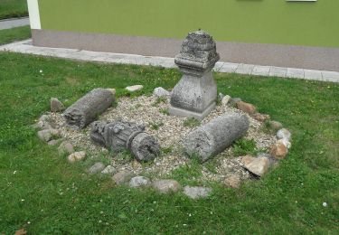
![Tocht Te voet Rapotín - [M] - Photo](https://media.geolcdn.com/t/375/260/2389b978-f881-4d49-8011-c5e6270880f1.jpeg&format=jpg&maxdim=2)
![Te voet Te voet](https://static1.geolcdn.com/sitytour/trail-icons/100.png)
[M]
Te voet
Gemakkelijk
Rapotín,
Centraal-Moravië,
Olomoucký kraj,
Czech Republic
![](/images/other/stat-length.png)
5,4 km | 9,4 km-effort
2h 8min
![](https://static1.geolcdn.com/siteimages/upload/files/16400158638029165_repeat_loop_refresh_sync_direction_icon.png)
Neen
![Tocht Te voet Rapotín - naučná stezka Bukovka - Photo](https://media.geolcdn.com/t/375/260/ca426870-e86c-4a96-bde0-2f91190915ef.jpeg&format=jpg&maxdim=2)
![Te voet Te voet](https://static1.geolcdn.com/sitytour/trail-icons/100.png)
naučná stezka Bukovka
Te voet
Gemakkelijk
Rapotín,
Centraal-Moravië,
Olomoucký kraj,
Czech Republic
![](/images/other/stat-length.png)
7,4 km | 11 km-effort
2h 29min
![](https://static1.geolcdn.com/siteimages/upload/files/16400158638029165_repeat_loop_refresh_sync_direction_icon.png)
Ja
![Tocht Te voet Zlaté Hory - Údolská hornická NS - Photo](https://media.geolcdn.com/t/375/260/99915314-0901-4649-b525-968123ac805f.jpeg&format=jpg&maxdim=2)
![Te voet Te voet](https://static1.geolcdn.com/sitytour/trail-icons/100.png)
Údolská hornická NS
Te voet
Gemakkelijk
Zlaté Hory,
Centraal-Moravië,
Olomoucký kraj,
Czech Republic
![](/images/other/stat-length.png)
7 km | 11,6 km-effort
2h 37min
![](https://static1.geolcdn.com/siteimages/upload/files/16400158638029165_repeat_loop_refresh_sync_direction_icon.png)
Neen
![Tocht Te voet Vápenná - Latzelova stezka - Photo](https://media.geolcdn.com/t/375/260/eb9b14b8-aff6-4c45-9daa-f6f941bf764d.jpeg&format=jpg&maxdim=2)
![Te voet Te voet](https://static1.geolcdn.com/sitytour/trail-icons/100.png)
Latzelova stezka
Te voet
Gemakkelijk
Vápenná,
Centraal-Moravië,
Olomoucký kraj,
Czech Republic
![](/images/other/stat-length.png)
4,4 km | 6,3 km-effort
1h 26min
![](https://static1.geolcdn.com/siteimages/upload/files/16400158638029165_repeat_loop_refresh_sync_direction_icon.png)
Neen
![Tocht Te voet Lipová-lázně - NS Schroth Priessnitz - Photo](https://media.geolcdn.com/t/375/260/5a5c4a4c-ba31-42b5-84dd-beb4dced3873.jpeg&format=jpg&maxdim=2)
![Te voet Te voet](https://static1.geolcdn.com/sitytour/trail-icons/100.png)
NS Schroth Priessnitz
Te voet
Gemakkelijk
Lipová-lázně,
Centraal-Moravië,
Olomoucký kraj,
Czech Republic
![](/images/other/stat-length.png)
3,9 km | 4,9 km-effort
1h 7min
![](https://static1.geolcdn.com/siteimages/upload/files/16400158638029165_repeat_loop_refresh_sync_direction_icon.png)
Neen